Adam's Calender
Summarised from an article by Dan Eden for Viewzone.com and an article by Michael Tellinger on Ufodigest.com.
They have always been there. People noticed them before. But no one could remember who made them -- or why? Until just recently, no one even knew how many there were. Now they are everywhere -- thousands -- no, hundreds of thousands of them! And the story they tell is the most important story of humanity. But it's one we might not be prepared to hear.
The discovery
Something amazing has been discovered in an area of South Africa, about 150 miles inland, west of the port of Maputo. It is the remains of a huge metropolis that measures, in conservative estimates, about 1500 square miles. That's bigger than Johannesburg nowadays. It's part of an even larger community that is about 10,000 square miles and appears to have been constructed -- are you ready -- from 160,000 to 200,000 BCE!
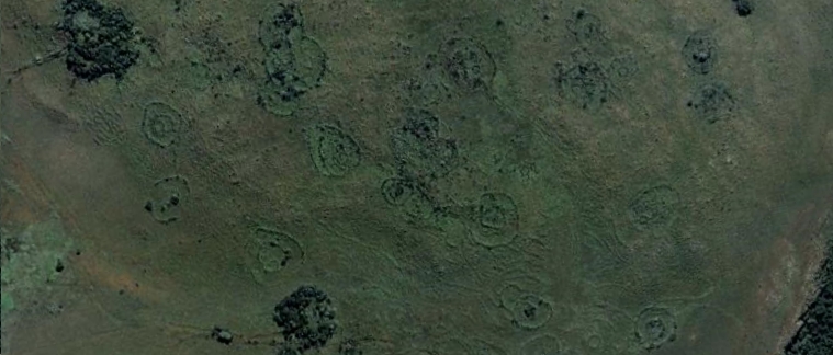
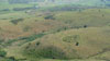
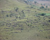
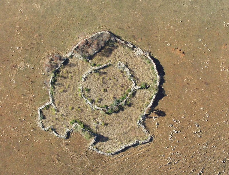
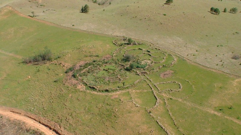
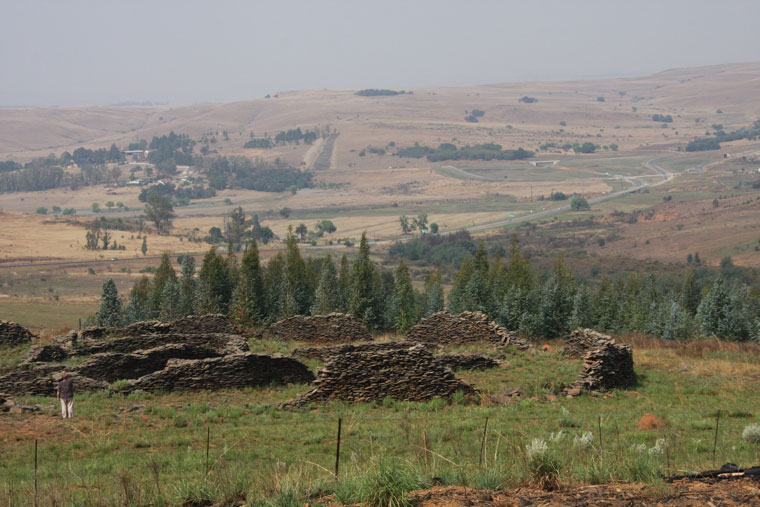
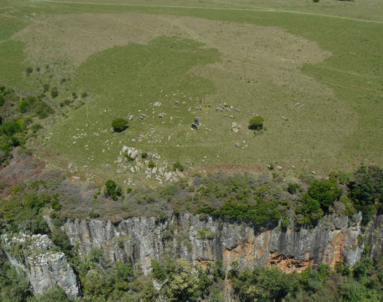
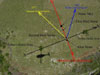
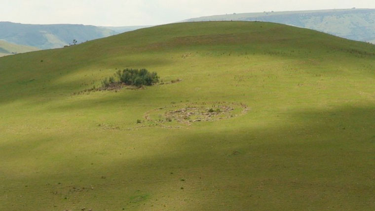
The image above is a close-up view of just a few hundred meters of the landscape taken from Google Earth (coordinates: 25 54' 07.13" S / 30 16' 48.04" E). The region is somewhat remote and the "circles" have often been encountered by local farmers who assumed they were made by some indigenous people in the past. But, oddly, no one ever bothered to inquire about who could have made them or how old they were.
This changed when researcher and author, Michael Tellinger, teamed up with Johan Heine, a local fireman and pilot who had been looking at these ruins from his years flying over the region. Heine had the unique advantage to see the number and extent of these strange stone foundations and knew that their significance was not being appreciated.
"When Johan first introduced me to the ancient stone ruins of southern Africa, I had no idea of the incredible discoveries we would make in the year or two that followed. The photographs, artifacts and evidence we have accumulated points unquestionably to a lost and never-before-seen civilization that predates all others -- not by just a few hundred years, or a few thousand years... but many thousands of years. These discoveries are so staggering that they will not be easily digested by the mainstream historical and archaeological fraternity, as we have already experienced. It will require a complete paradigm shift in how we view our human history," says Tellinger.
Where it was found:
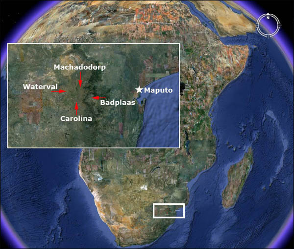
To see the number and scope of these ruins, I suggest that you use google-earth and start with the following coordinates:
Carolina -- 25 55' 53.28" S / 30 16' 13.13" E
Badplaas -- 25 47' 33.45" S / 30 40' 38.76" E
Waterval -- 25 38' 07.82" S / 30 21' 18.79" E
Machadodorp -- 25 39' 22.42" S / 30 17' 03.25" E
Then perform a low flying search inside the area formed by this rectangle. They're everywhere.
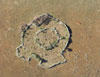
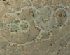
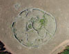
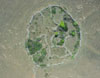
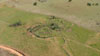
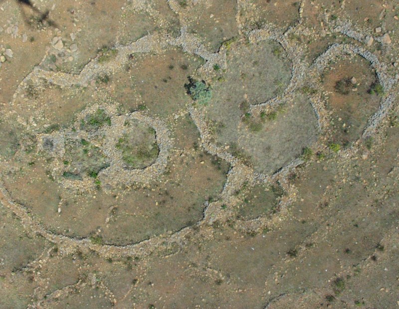
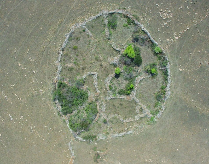
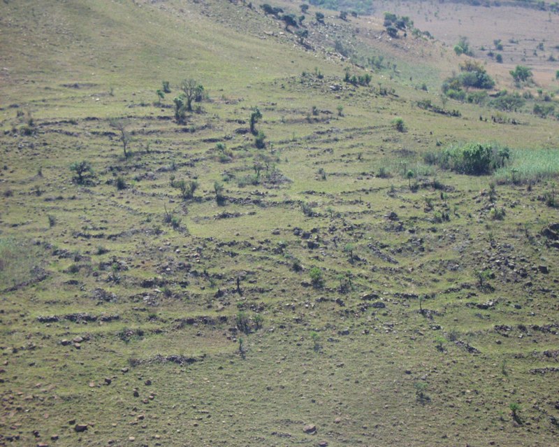
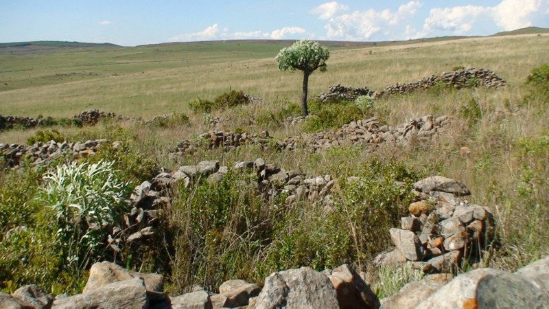
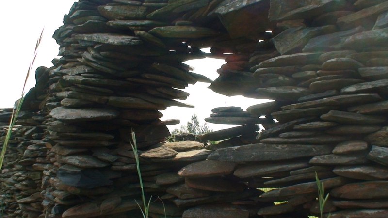
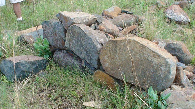
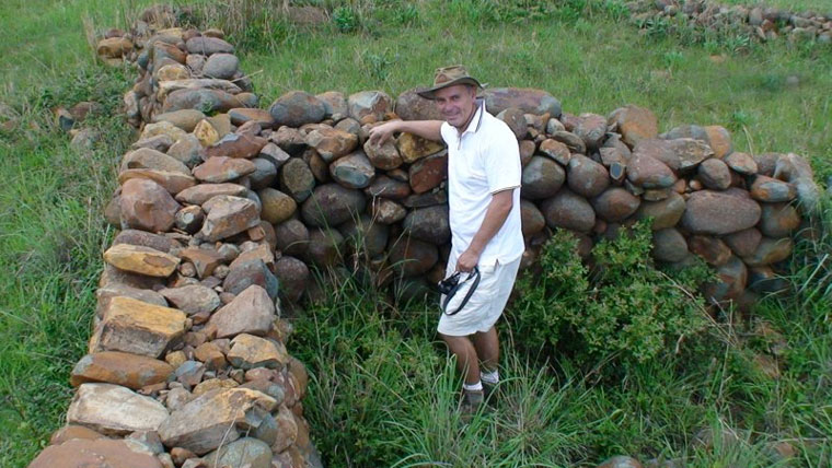
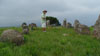
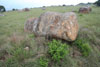
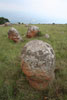
Some pictures of the ruins:


The area is significant for one striking thing -- gold. "The thousands of ancient gold mines discovered over the past 500 years, points to a vanished civilization that lived and dug for gold in this part of the world for thousands of years," says Tellinger. "And if this is in fact the cradle of humankind, we may be looking at the activities of the oldest civilization on Earth."
Did gold play some role in the dense population that once lived here? The site is just about 150 miles from an excellent port where maritime trade could have helped to support such a large population. But remember -- we're talking almost 200,000 years ago!
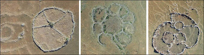
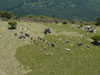
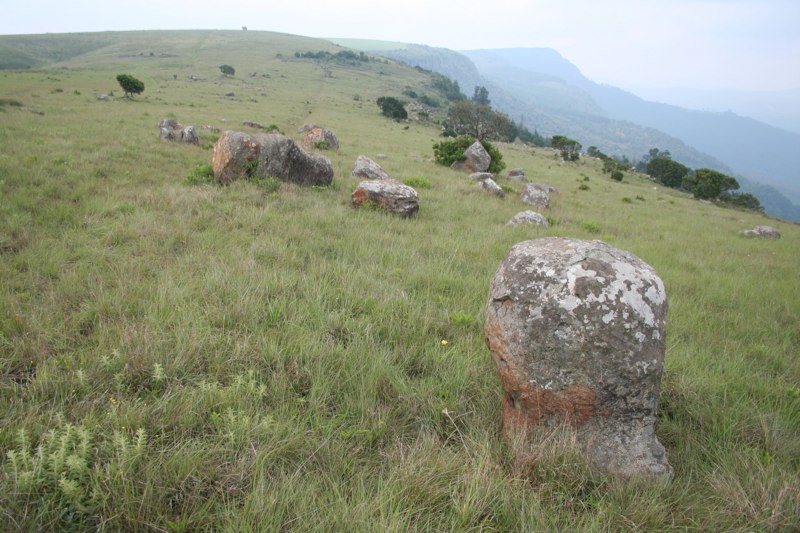
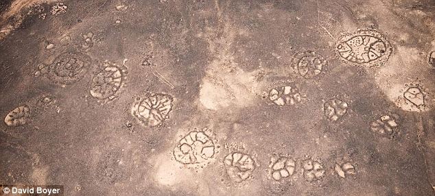
The individual ruins mostly consist of stone circles. Most have been buried in the sand and are only observable by satellite or aircraft. Some have been exposed when the changing climate has blown the sand away, revealing the walls and foundations.
"I see myself as a fairly open-minded chap but I will admit that it took me well over a year for the penny to drop, and for me to realise that we are actually dealing with the oldest structures ever built by humans on Earth.
The main reason for this is that we have been taught that nothing of significance has ever come from southern Africa. That the powerful civilizations all emerged in Sumeria and Egypt and other places. We are told that until the settlement of the BANTU people from the north, which was supposed to have started sometime in the 12th century AD, this part of the world was filled by hunter gatherers and so-called Bushmen, who did not make any major contributions in technology or civilization," says Tellinger.
A rich and diverse history
When explorers first encountered these ruins, they assumed that they were cattle corals made by nomadic tribes, like the Bantu people, as they moved south and settled the land from around the 13th century. There was no previous historical record of any older civilization capable of building such a densly populated community. Little effort was made to investigate the site because the scope of the ruins was not fully known.
Over the past 20 years, people like Cyril Hromnik, Richard Wade, Johan Heine and a handful of others have discovered that these stone structures are not what the seem to be. In fact these are now believed to be the remains of ancient temples and astronomical observatories of lost ancient civilizations that stretch back for many thousands of years.
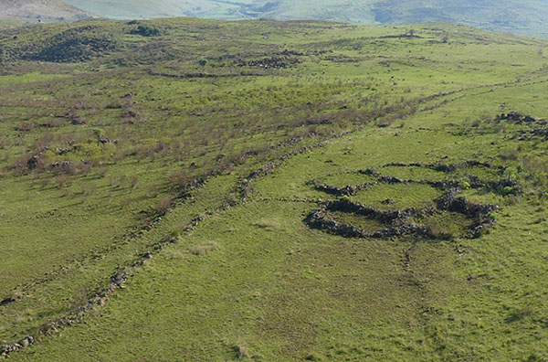
These circular ruins are spread over a huge area. They can only truly be appreciated from the air or through modern sattelite images. Many of them have almost completely eroded or have been covered by the movement of soil from farming and the weather. Some have survived well enough to reveal their great size with some original walls standing almost 5 feet high and over a meter wide in places. They can be found in South-Africa, Zimbabwe, Botswana, Zambia, Kenya and Mozambique. What's remarkable, is that none seem to have an entrance.
Looking at the entire metropolis, it becomes obvious that this was a well planned community, developed by a highly evolved civilization. The number of ancient gold mines suggests the reason for the community being in this location. We find roads -- some extending a hundred miles -- that connected the community and terraced agriculture, closely resembling those found in the Inca settlements in Peru. They cover over 200,000 square kilometres and possibly much more. Other roads lead to ancient gold mines, of which over 2,000 have been found.
The position of the ancient road sections that we have discovered suggest that it once ran continuously from the coast of Mozambique to Botswana and possibly beyond. A rough calculation shows that the original ancient roads would have required over 500 million stones of between 10 and 50 kilograms to construct. If we assume that the roads only make up 2 percent of the ancient settlements, the number of stones required to build the entire ancient city becomes unthinkable. This is simply not possible with the current model of ancient civilisation in southern Africa. The other issue we need to deal with is the need for roads, since it was previously believed that the wheel only arrived in this part of the world with the Portuguese explorers in the 1400's.
The dating of the site
Once the ruins were examined, the researchers were anxious to place the lost civilization in a historical perspective. The rocks were covered with a patina that looked very old but there were no items sufficient for carbon-14 dating. It was then that a chance discovery revealed the age of the site, and sent a chill down the spine of archaeologists and historians.
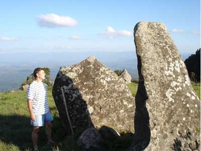
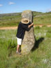
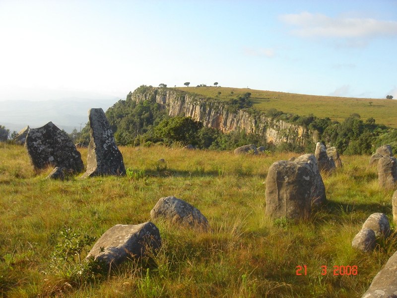
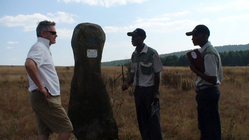
Tellinger: "Johan Heine discovered Adam's Calendar in 2003, quite by accident. He was on route to find one of his pilots who crashed his plane on the edge of the cliff. Next to the crash site Johan noticed a very strange arrangement of large stones sticking out of the ground. While rescuing the injured pilot from about 20 metres down the side of the cliff, Johan walked over to the monoliths and immediately realised that they were aligned to the cardinal points of Earth -- north, south, east and west. There were at least 3 monoliths aligned towards the sunrise, but on the west side of the aligned monoliths there was a mysterious hole in the ground -- something was missing."
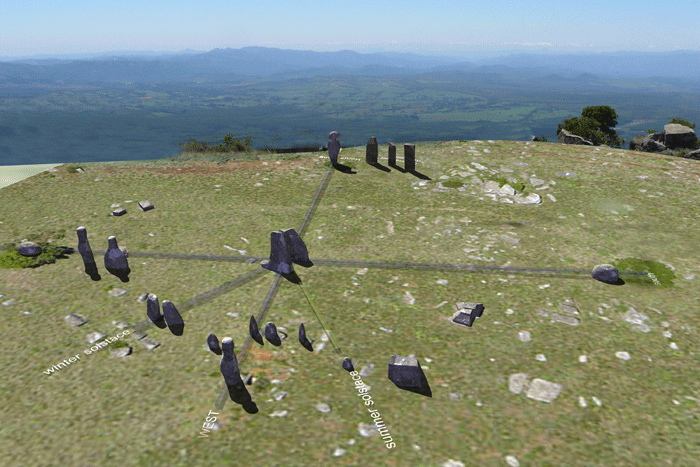
After weeks and months of measuring and observations, Johan concluded that it was perfectly aligned with the rise and fall of the Sun. He determined the solstices and the equinoxes. After an extensive search, Johan also found the missing anthropomorphic (humanoid shape) stone. It was intact and proudly placed with a plaque stuck to it. It had been used by the Blue Swallow foundation to commemorate the opening of the Blue Swallow reserve in 1994.
It's difficult to see however, due to the modest size of the monument
The first calculations of the age of the calendar were made based on the rise of Orion, a constellation known for its three bright stars forming the "belt" of the mythical hunter.
The Earth wobbles on its axis and so the stars and constellations change their angle of presentation in the night sky on a cyclical basis. This rotation, called the precession completes a cycle about every 26,000 years. By determining when the three stars of Orion's belt were positioned flat (horizontal) against the horizon, we can estimate the time when the three stones in the calendar were in alignment with these conspicuous stars.
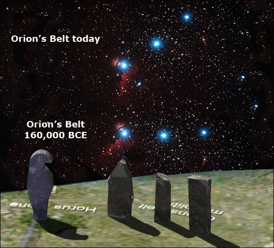
The first rough calculation was at least 25,000 years ago. But new and more precise measurements kept increasing the age. The next calculation was presented by a master archaeoastronomer who wishes to remain anonymous for fear of ridicule by the academic fraternity. His calculation was also based on the rise of Orion and suggested an age of at least 75,000 years. The most recent and most acurate calculation, done in June 2009, suggests an age of at least 160,000 years, based on the rise of Orion -- flat on the horizon -- but also on the erosion of dolerite stones found at the site.
Some pieces of the marker stones had been broken off and sat on the ground, exposed to natural erosion. When the pieces were put back together about 3 cm of stone had already been worn away. These calculation helped assess the age of the site by calculating the erosion rate of the dolerite.
 |
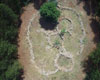
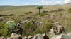
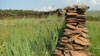
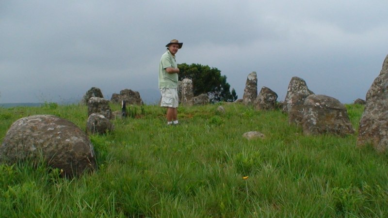
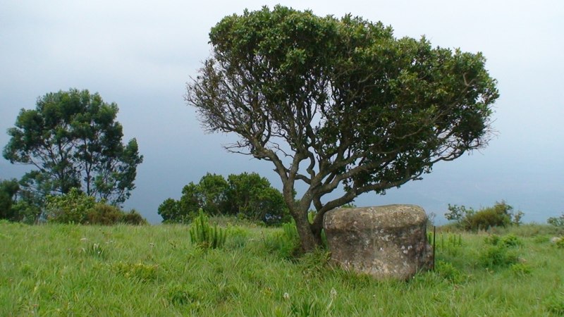
Some pictures of the monument:


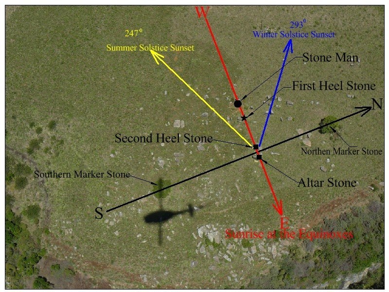
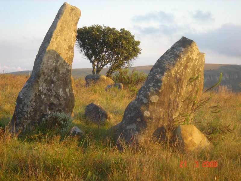


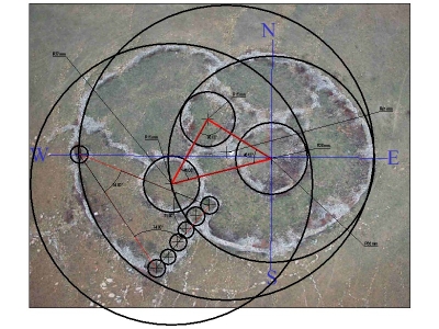
This remarkable stone structure of Adam's Calendar was originally a large circular structure resembling but predating Stonehenge by many thousands of years. Its original shape is still clearly visible from satellite images. Adam's Calendar is built along the same 31 degree longitudinal line as Great Zimbabwe and the Great Pyramid of Giza.
A recent observation is that the fallen monolith on the outer circle that marks the vernal equinox sunrise is shaped like the Horus hawk head from Egypt and the resembles the Zimbabwe ruins birds. This is the oldest statue of the Horus hawk by a long shot.
Many of the circular structures are aligned to specific geographic points including solstices and equinoxes. But only when Johan Heine began to experiment with other possible encoded geometry, that the real hidden secrets of the ruins began to emerge. They are riddled with sacred geometry, Reiki symbolism and the Phi factor or golden ratio of 1,618.
Why the interest in gold?
South Africa is known as the largest gold producing country of the world. The largest gold producing area of the world is Witwatersrand, the same region where the ancient metropolis is found. Realizing that sites of abandoned ancient mines may indicate where gold could be found, South Africa's leading mining corporation, the Anglo-American Corporation, in the 1970s engaged archaeologists to look for such ancient mines. Published reports (Optima) detail the discovery in Swaziland and other sites in South Africa of extensive mining areas with shafts to depths of fifty feet. Stone objects and charcoal remains established dates of 35,000, 46,000, and 60,000 B.C. for these sites. The archaeologists and anthropologists who joined in dating the finds believed that mining technology was used in south- ern Africa "during much of the period subsequent to 100,000 B.C.
It seems highly probable that the ancient metropolis was established because of its proximity to the largest supply of gold on the planet. But why would ancient people work so hard to mine gold? You can't eat it. It's too soft to use for tool making. It isn't really useful for anything except ornaments and its physical beauty is on a par with other metals like copper or silver. Exactly why was gold so important to early homo sapiens?
To explore the answer we need to look at the period of history in question -- 160,000 to 200,000 years BCE -- and learn what was happening on planet Earth.
 |
I'll be honest with you. This next part of the story is difficult to write. It's so shocking that the average person will not want to believe it. If you are like me, you'll want to do the research yourself, then allow some time for the facts to settle in your mind.
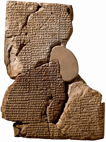
We are often made to believe that the Egyptians -- the Pharoahs and pyramids -- are where our known history begins. The oldest dynasties go back some 3200 years BP. That's a long time ago. But the Sumerian civilization, in what is now Iraq, is much older. What's more, we have translated many of their history tablets, written in cuneiform and earlier scripts so we know a lot about their history and legends.
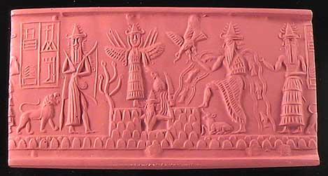
The seal image above, depicts the legend of the "Great Flood" which consumed mankind. Many Sumerian legends are strikingly similar to Genesis. Like Genesis, the Sumerian legend, Atrahasis, tells the story of the creation of modern humans -- not by a loving God -- but by beings from another planet who needed "slave workers" to help them mine gold on their extra-planetary expedition!
I warned that this is difficult to believe, but please keep reading.
 |
The gods had to dig out the canals
Had to clear channels,
the lifelines of the land,
The gods dug out the Tigris river bed
And then they dug out the Euphrates.
(Dalley 9, Atrahasis)
After 3,600 years of this work, the gods finally begin to complain. They decide to go on strike, burning their tools and surrounding the chief god Enlil.
Enlil confers with other upper-class gods. They now see that the work of the lower-class gods "was too hard," and they decide to sacrifice one of the rebels for the good of all. They will kill him, and make mankind by mixing the god's flesh and blood with clay:
Belit-ili the womb-goddess is present,
Let the womb-goddess create offspring,
And let man bear the load of the gods!
(Dalley 14-15, Atrahasis)
What follows is a complicated procedure, surrounded by ceremony. The creation of man seems to be described as a type of cloning and what we would today consider in vitro fertilization.
The result was a hybrid or "evolved human" with enhanced intellect who could perform the physical duties of the worker gods and also take care of the needs of all the gods.
We are told, in other texts, that the expedition came for gold and that great quantities were mined and shipped off the planet. The community in South Africa was called "Abzu" and was the prime location of the mining operation.
Since these events appear to coincide with the dates of "Mitochondrial Eve" (i.e. 150,000 to 250,000 BP) and appear to be located in the richest gold mining region on the planet (Abzu), some researchers are thinking that the Sumerian legends may, in fact, be based on historical events.
"The Great Flood"
According to the same texts, once the mining expedition ended it was decided that the human population should be allowed to perish in a flood which was predicted by the astronomer of the "gods." Apparently, the cyclical passage of the home planet of the gods, Nibiru, was going to bring it close enough to the orbit of Earth that its gravity would cause the oceans to rise and flood the land, putting an end to the hybrid species -- homo sapiens.
According to the story, one of the "gods" had sympathy for a particular human, Zuisudra, and warned him to construct a boat to ride out the flood. This eventually became the basis for the story of Noah in the book of Genesis.
The Sumerian legends are not the only ancient texts that speak of this remarkable story. Regarding the most ancient gold mines of Monotapa in southern Zimbabwe, Zulu legends hold that they were worked by "artificially produced flesh and blood slaves created by the First People." These slaves, the Zulu legends recount, "went into battle with the Ape-Man" when "the great war star appeared in the sky" (see Indaba My Children, by the Zulu medicine man Credo Vusamazulu Mutwa).
Did this really happen? The only other explanation is to imagine that the Sumerian legends, acknowledging life on other planets and human cloning, were extraordinary science-fiction. This in itself would be amazing. But we now have evidence that the mining city, Abzu, is real and that it existed in the same era as the sudden evolution of hominids to homo sapiens.
Just think about this for a while.
- A video about "Adam's Calendar", made before the most recent calculations, can be found here.
- Michael Tellinger sums up the most important questions that can't be answered by modern day science, but that can easily be explained if you take the possibility of extraterrestrial intervention into consideration, here.
- Michael Tellinger's new book "Temples Of The African Gods" is now in print and will be available in South Africa, UK and USA from about Feb 2010.
- Update September 15, 2011: Similar formations have now also been found in Syria, Saudi Arabia and Jordan:
- Update April 2, 2012: Michael Tellinger discovered three strange looking mountains in South-Africa that have the shape of pyramids, and are in the same formation as the great pyramids in Egypt, resembling the constellation of Orion. More research will be done.